Sandakphu is the tallest peak of West Bengal, india among the Singalila mountain range.. The highest altitude is 3,636 meter and it is situated in the Singalila National Park at the West Bengal. The highest point of the Singalila mountain range of Eastern Himalayas. The meaning of the word Sandakphu is ‘Height of the poison plants.’ One kind of poisonous Aconite is found near the Sandakphu peak (at Bikhevanjyan) and the peak is named after those plants. It’s at the border of India and Nepal.
This trek can be considered as the ideal ground for a trekker to hone on his skill to ultimately trek the huge area of Himalayas. From the summit of the Sandakphu through a 360 degree view, four of the five highest peaks- Everest, Kangchenjunga, Lhotse and Makalu can be seen.
During the dawn, when the sunlight falls on the Kanchenjunga massif, the sleeping Buddha arises. The peaks of Kumbhakarna, Kanchenjunga, Koktang, Rathong, Frey, Kabru, Simvo and Pandim create the appearance of a resting Buddha.
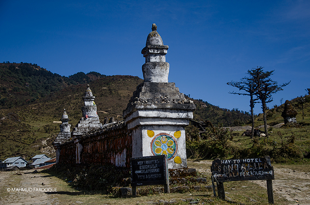
Another important feature of this trail is the Kalapokhari or the Black Lake. It is said that the black water of this lake never freezes. Hence the Buddhists observe the place as a holy one.
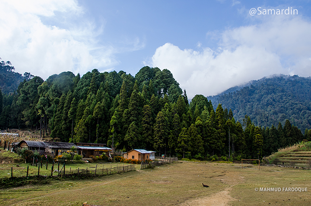
The trek consisted of colorful Rhododendrons, High pine forest and the inhabitants of Red Pandas are found in the Singalila National Park. As it is a mid-tough trek so it is ideal for them who want to start trekking in high altitude. Not only the spellbinding beauty but the trek is good for evaluating oneself in extremely high altitude and cold weather of Himalayas.
Trekking Schedule
There are many ways to do this trek even reverse, but we will just discuss about all the popular ways to get this trek done.
We have made few sets and we are sure it will fit for all sorts of people who wants to visit this place. Remember, taking a guide is mandatory by the local authority but if you are using jeep safari then you won’t be needing to take a guide.
Set 1 – Photographic Tour
Slow Trekking more Photography.
This Schedule is suitable for both professional and amateur photographers who wants to get the best view of the mountains and the diversity of the nature. Possible camera lens suggestion would be a wide angle, a telephoto and an extra wide angle for astrophotography. Specifically for this plan, you have to do this trek during mid October to early November season to get the best view of Kanchenjunga and Everest belt. Yet due to the global weather changes the season could last till early December.
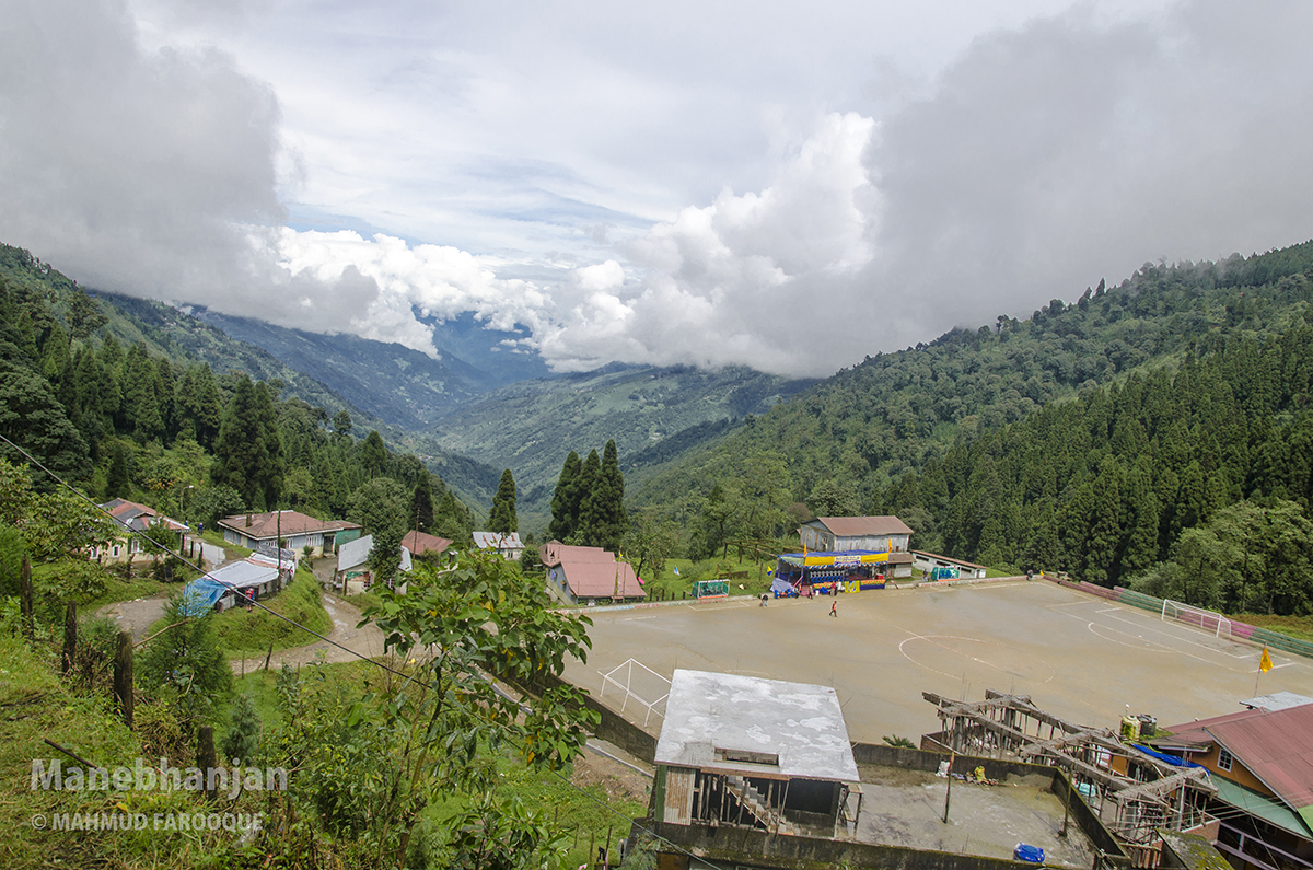
Day [1] Manebhanjan night stay:
Wherever you are coming from, you have to be at Siliguri to reach out Manebhanjan – Night Stay.
On your way to Manebhanjan from Siliguri, you have to take a halt at Mirik for some awesome landscape shots.
Day [2] Manebhanjan to Tonglu:
Tonglu is the iconic photographic place for landscape. You can capture the water hole at the front which holds the color of the sky and reflects the cottage then the cottage in the middle and Kanchenjunga at the horizon.
Day [3] Tonglu to Kalapokhari
Day [4] Kalapokhari to Sandakphu
Day [5] A day around Sandakphu
There is a view point at the top of sandakphu that you have to climb up a little to the top. Usually Guides don’t encourage you to get there but please make sure to force him to take you there with all of your camera gears and please be careful to hike up there and get down because the trek is steeply. From that view point you will have the 360 view of Kanchenjunga and Everest belt on your sight.
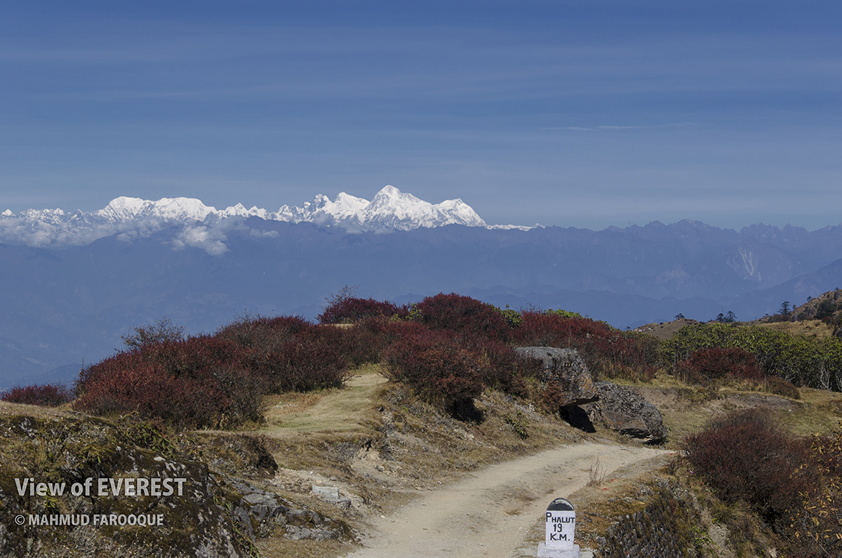
Day [6] Sandakphu to Phalut via Sabargram
You must be well equipped with drinking water because throughout this 21 km trek you may not find drinking water supply at all. There are chances that you will find food and water at the SSB Check post in Sabargram which is 14 km away from sandakphu, but that check post is not assured to be opened regularly.
Day [7] Phalut to Gorkhey
If you have a clear view of the snowcapped mountains then I would suggest you to stay for another day in Phalut and just enjoy the view at the view point which is little away from the trekking HUT. You can actually take everything with you there or you can ask the guide to bring food there and have your lunch.
If you are leaving Phalut to Gorkhey then you will start experiencing the most charming view of the Singalila Forest. The trek lead to the middle of the forest where you will find many types of birds singing and some really old trees.
Day [8] Gorkhey night stay
This would be your golden opportunity to test your photographic skill in this particular place where you will find so much natural diversion around you that you can spend an entire day. There are streams and pine trees that makes the place so magical that sometimes you may want to sit down think of not going anywhere.
Day [9] Gorkhey to Srikhola
Day [10] Srikhola to Rimbik and Jeep to back Manebhanjyang or Darjeeling.
Set 2 – Trekking Tour
More Hiking Fun
This schedule is designed for trekker who wants to have more fun on the trek by saving time and throwing hiking challenge. This is the most convenient plan for people who has less time to get this trek done.
Day [1] Manebhanjan to Tumling / Gairibas / Khalapokhari
If you reached to Manebhanjan early and still have 2 hours of daylight, then you can easily hike up to Chitrey (4km) and stay there at Howk’s Nest Lodge and start early tomorrow to reach as far as Kalapokhari.
OR else you can finish the process of Passport Entry and Guide selection before dark so you can have early start tomorrow without any logistics bindings. Guide will come anytime when you ask them to and wake you up.
OR else if you reach Manebhanjan and everything is closed already then please start early tomorrow and make the logistic process like Passport Entry, Guide selection, Singalila Park Entry Ticket etc. fast and early and hopefully you can reach up till Gairibas, and still if you have 2 hours daylight left after reaching Gairibas then you can start for Kalapokhari.
Day [2] Tumling / Gairibas / Khalapokhari to Sandajkphu
Wherever you are staying at Day 1, next destination is Sandakphu. But if you are ahead of the course then you will reach Sandakphu early and enjoy the glowing light pointing at Kanchenjunga in the evening.
Day [3] Sandakphu to Phalut
Day [4] Phalut to Ramam
Day [5] Ramam to Manebhanjan or Darjeeling via Rimbik.
At Rimbik, you will find shared jeep to get back Darjeeling via Manebhanjan.
Set 3 – Jeep Safari
It’s all about Family.
if you want to take your family or kind of person who does not want to trek or kids or even you who just want to see what it is without trekking and perhaps saving time then this is just for you.
Manebhanjan to Sandakphu via Jeep
There are many 4WD 1954 Land Rover which only takes up to 4/5 passenger on this route but recently some new 4WD jeep added to the vehicle stand. Usually they charge 42000/- INR if you get up to Sandakphu and back to Manebhanjan in the same day. OR else if you want to have a night stay at Sandakphu and get back to Manebhanjan day after then they will charge 48000/- INR . If you get there via Jeep then you won’t need to take guide and you don’t have to bear the cost of the lodge and food for the driver as well.
Sandakphu to Phalut via Jeep
If the road is stable and has no issue then you can take the jeep from Manebhanjan to Sandakphu to all the way to Phalut and back to Manebhanjan. That could take 8000 / 8500 INR for the entire round trip. There is no jeep trail after Phalut.
Trekking Plan
A minute plan is absolute necessarily for any trekking. Even if your group has a leader you may need to come back alone in case of emergency. So it is urgent to know the full plan of the team.
Sandakphu-Phalut trek basically starts at Manebhanjan and ends here The four-wheel drives (1954 Land Rover) or the latest Mahindra/ Bolero goes up to Sandakphu from Manebhanjan and if the road remains good you may take them up to Phalut because the whole way up to that point is has the road suitable for cars.
If Darjeeling is not included in your tour plan in that case for trekking Sandakphu-Phalut your estimated cost will be approximately 130-200$ from Siliguri to the entire trek and back to either SIliguri or Darjeeling.
You have to enlist your name for this trek at Manebhanjan. Moreover, you have to buy an entry ticket of Singalila National Park and take a guide who is registered in the guide association’s list and that is must.
Anybody can alter the day-wise trek plan according to one’s choice and necessity. For example, One can come back straight to SriKhola(without staying at Gorokh) from Sandakfu to Phalut if one has not much time.
To let the nature grow naturally in the rain, the entry of tourists inside the Singalila Range is restricted from June 15 to September 15 in every year.
March-April-May:
During this season you will get plenty of Rhododendrons and you may be so mesmerized by this beautiful flower that you may even forget the mountains. There are chances of both rain and fog in this season but probability of rainfall increases in the end of May. One must prepare oneself by browsing internet to know the duration of daytime and weather forecast of those areas in that time of the year.
In this season you may not be able to see the Kanchenjunga and Everest very clearly from Sandakphu.
October-November:
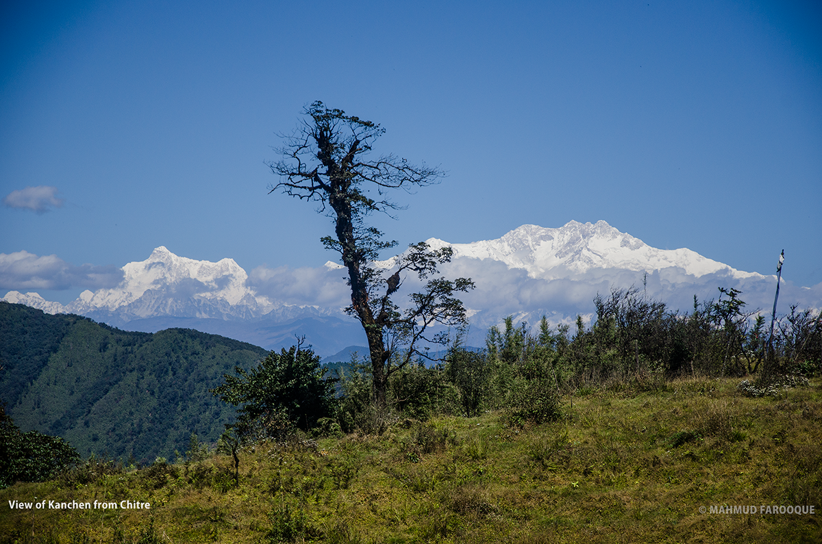
This is the best time to trek the Singalila area. One does not even need to go Sandakphu to see Kanchenjunga as that can be seen even from Chitra. But there is an ample amount of pressure of tourists in that time as it is people enjoy their puja vacation then. There may be some problem of dwelling. But these days many new tourist lodges are being built, so there is no concern about dwelling.
Temperature :
In different seasons the temperature of the day time is between 12-20 degree Celsius and at night between minus 0 to 5 degree Celsius. Along with the temperature tremendous wind may cause Wind Chill factor that gives another challenge in this trek. So, one must take good preparation regarding the clothes.
Clothes for Cold:
If you have sufficient dress and if you can effectively use them you will not suffer from cold at will at any height during the trekking. And the way of this is called Layer Clothing. It has been examined that wearing two thin dresses combats against the cold better than a thick dress. The Layer system is based in this theory. For such extreme environment one may use the layer described below:
Upper part:
- First Thermal synthetic inner
- A full sleeve synthetic half-shirt on it
- A cotton t-shirt on it ( full/half)
- A thin pull-over of floss
- Down Jacket ( optional)/ for this trek a good quality warm jacket is enough
- Wind Cheater/ Breaker
- Must have two pairs of thin woolen gloves or one pair of thick sock you may purchase from Mirik en route to Manebhanjan. The advantage of two thin woolen gloves is with that mobile phones and cameras could be operated but that is not possible with the thick one. If it is too cold one can wear one thin one on the other.
Normally during the day time trekking the body remains warm. As the temperature is little higher the down jacket is not needed while walking. One can walk comfortably with wind cheater. After finishing the trek putting up the wind cheater over the down jacket will protect the body from wind.
Lower Part:
Normally the lower portion of our body feels less cold. So round about three layers are good enough for the lower part. A thermal inner, a trouser made of cotton t-shirt fabric on it and a trekking trouser over it will be enough for one to sleep comfortably in the camp site. And during the day time trekking the middle layer is not needed to wear.
** But the whole thing depends on oneself. You may adjust the layer according to your capacity of endurance. The number of layers may be different for different persons.
Essential Kits
- Trekking boot: A trekking boot with a good grip is absolute prerequisite. The shoe must be comfortable as one has to trek in the up and down stone road in the stone terrain. The boot should be up to the ankle of the leg. Use the boot for 5-6 days before the trek. Do not start trekking right away with the brand-new shoe.
- Backpack: A good quality backpack is important for a comfortable trekking. A backpack with a good back system, gives load equally to shoulder and heap, do not pressurize on shoulder, is good for trekking. For this trek 40-50 liter backpack is adequate.
- Monkey cap/ balaclava: Balaclava is light in weight; it is a piece of funnel shaped fabric. It can be used as monkey cap, cover head, ears and in necessity even throat. In Sandakphu and in the way from Sandakphu to Phalut this is necessary amid tremendous wind.
- Poly bag: To save your belongings, pack everything separately with poly. Carry some extra zip lock/normal polythene. Especially at the end of the April-May rainfall is frequent.
- Head lamp/ torch: with extra battery. Keep in mind that the battery charge quickly finishes in cold. During the night while trekking or when you need to go to toilet at night you may need it so it is better if it is small in size.
- Sun glass: Sun ray is intensified when it falls on the ice and that reflects strongly on our eyes. So it is dangerous to trek in bare eyes. Snow blindness may occur. So a good quality ‘polarized’ sun glass is required. It will be required if someone goes to Sandakphu in January because that is the time of ice fall there.
- Hand gloves: it is very important. In extreme cold your hands, legs and nose will start to freeze. Specially the fingers of the hand. As the hands will be most open so your hand gloves must be good.
- Necessary medicines: Medicines of the primary first aid kit along with some cotton, gauge-bandage, Povidone Iodine, Savlon, Band Aid. I will make a detail list later.
- Camera, memory card, Power Bank- there is no electricity in most part of the trail.
- Trekking pole/ Walking stick- I suggest one should carry two poles. At least one. Using trekking pole reduces the pressure on the body. Having trekking pole is not a must thing, except snowfall.
- Trek Kit: Needle, thread, safety pin, 100-foot paracord. These things may be required at any time.
- Trail Mix/ Chocolate/ Candy: throughout the whole trek you will frequently find some villages, where you will find the arrangements of tea and snacks. Besides them you can also carry some food to change your taste during the trek. With the higher altitude the price will be higher but that will not be as much so that you cannot afford and need to carry a sack from Manebhanjan. But you will get things cheaply at the groceries of Manebhanjan.
- Water Bottle
Essential Papers
- Entry ticket of Singalala Park ( It should be collected from Manebhanjan but can also be collected from a check post after Meghma in the trek)
- Photocopy of passport: 2-3 copies (with visa page)
- Passport Size photo: Keep 4 copies. Passport size is good enough, two stump size photos along with them will be better so it will help to acquire a SIM card.
Trekking Detail
Siliguri to Manebhanjan
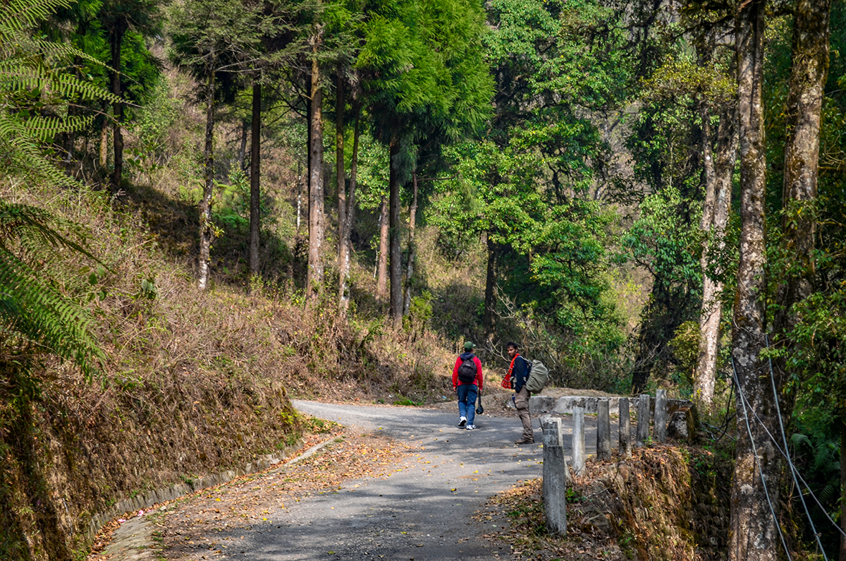
There is a jeep stand near the Mahananda Bridge called Darjeeling jeep stand. Mahindra/Bolero type passenger station wagon vehicles take passengers to Darjeeling and its surrounding area. Basically, the tourists and the local people ride on them together. You will seek Manebhanjan jeep there or the drivers may show them if asked. The rent up to Manebjhanjan will be 120-140 rupees.
It will take at least five hours to reach Manebhanjan. The jeeps are stopped in many places for passengers to ascend or descend or even just to take a cup of tea. Mind you if you feel the call of nature never hesitates to tell it to the driver as they tend to stop whenever they find a chance. The jeeps go to Manebhanjan from Siliguri through Mirik and SukiaPokhari.
The hilly road begins just after crossing the Siliguri Cantonment area. I urge you never take a pill of headache or vomit before riding on the jeep because if you consume them you cannot judge whether you have any problem or not for the high altitude. Yes, the car goes through a zigzag along the hilly roads and it will obviously cause some dizziness. In that case from my own Paragliding experience I can advise you that never look at anything that is moving or rolling, focus on anything that is static, for example, car’s dashboard or the seat.
Manebhanjan to Tumling
Time 4-5 hours, 14 Kilometers. Altitude 2150 meters to 3087 meters
After taking an early breakfast, you may reach Chitrey (2530m) that is 4 kilometers away in about one and a half hours of trekking. Chitrey is a small Buddhist village. There is a beautiful Buddhist temple. If the weather is clear, a beautiful view of Kanchenjunga from the trail is possible. Although the trail from Manebhanjan to Chitra is little steep but the evergreen pine, fur, birch, does not allow you to become tired. There is also a T-house there name Hawk’s Nest and they provide food and lodge with separate cottage as well.
From Chitrey in about three kilometers distance there is a little village called Lameydhura that consists of only five Tibetan families. As there is not much up and down in the trail from Chitrey to Lamydhura one can easily reach there in an hours. There is also arrangement for snacks and tea as well.
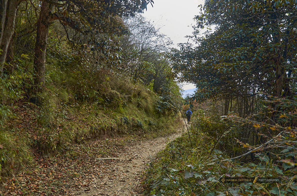
In a comfortable hour and a half’s journey the slightly steep trail will lead you to a little village called Meghma near the India-Nepal border, infect you will always be crossing borders unintentionally from Chitrey to all the way to Phalut. The entire trail is in between the borders of Nepal and India and you will see lots of border pillar on the trek and sometimes you will find yourself inside any one of these two countries. You will see magnolia trees during the journey. If you have good sight and get lucky you may see one or two red pandas as well. There is a SSB check post, where you have to register your name by showing your passport, ID card and other necessary documents.
There is a Buddhist temple nearby. You will get an intersection after walking 4-5 minutes. If you climb through a crooked steep road through in the right you will find Tonglu, which is almost as high as Sandakphu, and if the weather is clear the similar view like Sandakphu is available, that means the Kanchenjunga and Everest range can be seen. Hence many prefer a short tour up to Tonglu rather than going to Darjeeling. The experience of watching Kanchenjunga from this place early in the dawn will remain eternal. There are some home stays and private lodges here. There are arrangements for single, double and dorm rooms.
And if you take the left turn you will end up at Tumling where you will find many trekkers lodge and the view is just breathtaking. Don’t forget to check in all the available cottage before settling, because there are cottages which has better facilities than others. There is one called Shikhar Lodge and that is the most oldest and most suitable but you won’t be seeing anything from that lodge like the other lodges you can view Kanchenjunga from the rooftop.
Tumling to Kalkapokhari
Time 4-5 hours, 11 kilometers, altitude: 3087 meters to 3170 meters
During the sunrise watching the whole Kanchenjunga family from the open verdant field of Tumling field is a pulsating experience. The right most peak of this family is Kumvakarna. Kanchenjunga and Simvo is just behind like walls. Underneath Kanchenjunga there is Koktang, Rathong, Frey, South Kabru, North Kabru, Goyecha and Pandymersirigiri can be seen. The middle saddle between Goyecha and Pandim is the historical Goyecha la Pass.
A jeep way and a walkway goes further from here. The walking trail goes up to Gairibas via Jaubari and the car way goes straight to Gairibas. The trekking trail goes through the dense forest and verdant open field. It takes about three hours to reach Nepali village Gairibas from Tumling. There is another concrete jeep way that goes through the deep forest and goes straight to Kalapokhari.
After about one and a half hours of up and down road one will get Kaiyakata. Stairs are set here for the trekkers. This is the starting point of the SSB Camnp and Sangilila National Park. There is arrangement of lunch in Kaiyakata.
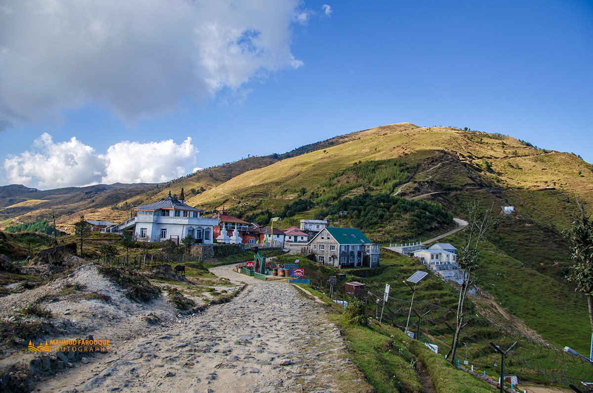
Kalapokhari is almost four kilometers away from Kaiyakata. The stony road is almost flat for car drive. Plenty of Birds are seen throughout the road. After about 90-120 minutes’ trekking, a bean-seed shaped black lake will be seen. That is the Kalapokhari Lake. It is adorned by colorful prayer flag. There is a Buddhist temple nearby. That place is also in the India-Nepal border. After 5-10 minutes of walking one will get the lodge for night stay and dinner.
Bikhyebhanjan to Sandakphu
Altitude 3170 meters to 3636 meters, time: three hours distance six kilometers
Today’s trek is comparatively easier and comfortable till Bikhebhanjan and after, it will be a real test of your stamina to use last drop of strength in your body. Starting from Kalapokhari trek you will trek to Bikhjebhanjan through Vapsa within 30-40 minutes. Bikhevanjyan means poisonous valley and the poisonous Aconite plants are grown here. One can fill up the water bottles here and can have a tea break, after the tea break the road ahead is very steep and one cannot afford to rest till Sandakphu. If the weather is very rough the shops here may not be opened so it is better to carry the extra reserve of water from Kalapokhari. From here basically two roads lead to Sandakphu. One road is through Nepal and this one takes a little longer but less steep. The other one that goes through India is shorter but it goes straight up through, a zigzag of very steep slope.
Try to reach Sandakphu before afternoon. With the light of afternoon the Himalayas look scintillating. Go to view point before sunrise of next morning.
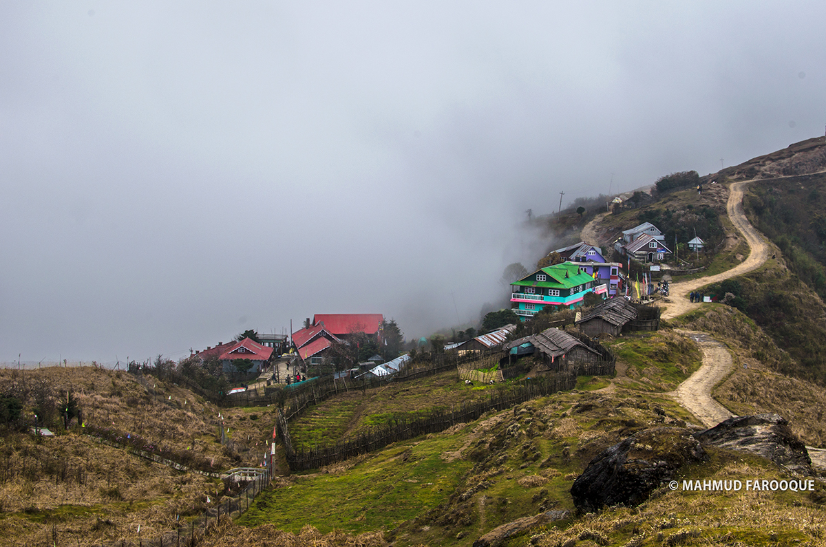
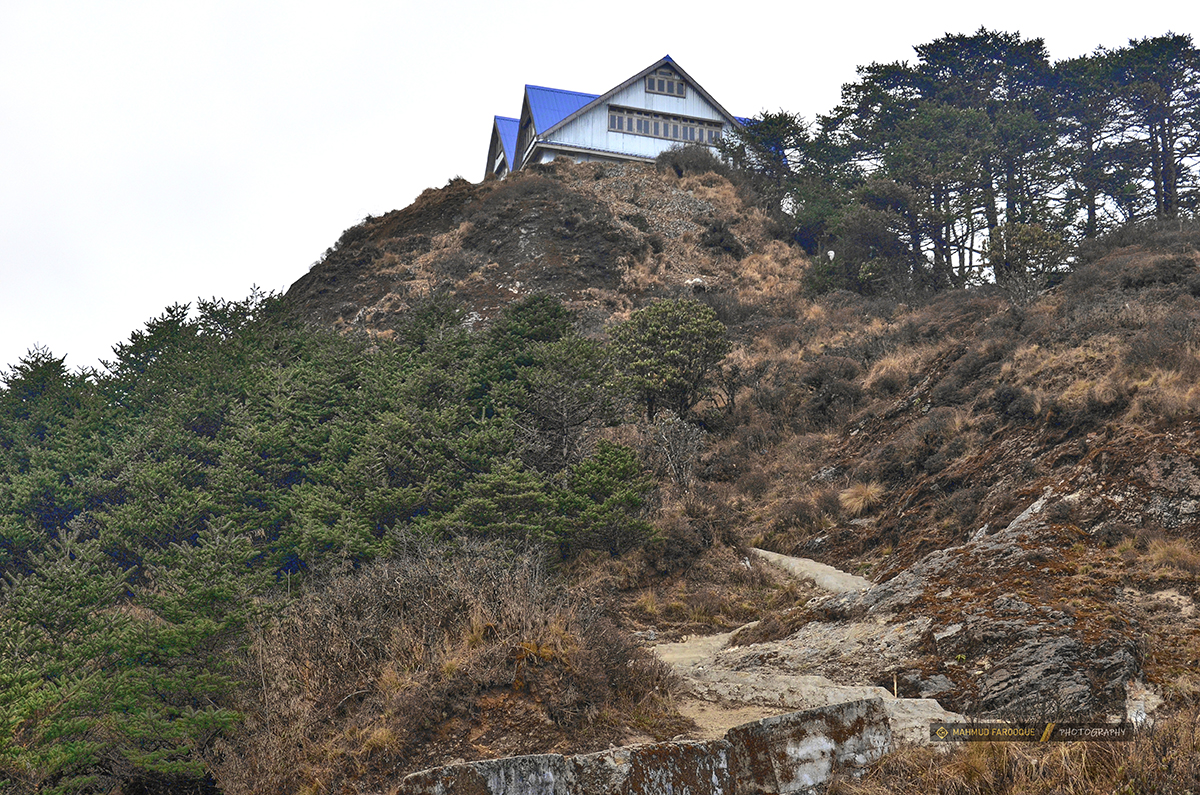
There are many cottages at Sandakphu but the government dormitories are better. Their culinary is better than that of others. But you can also stay at Sherpa Chalet (the four-storied blue wooden house that can be seen from Kalapokhari) and get down to a dormitory to take your meal from a kitchen by paying money.
Sandakphu to Phalut
Time 7-8 hours, 21 kilometers, altitude 3636 meters to 3599 meters
One must get up very early in as the whole beauty of this trek lies in this next phase. If you asleep or being late during the very early dawn, the prize of the trek will be lost. The memorable moment will be lost with the blink of an eye. So throw aside your laziness and take position at the view point 30 minutes before the sunrise.
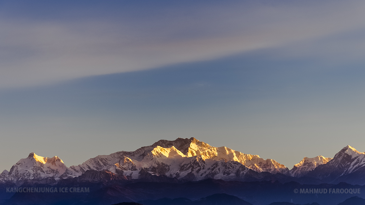
When the morning sun reflects its golden ray on the white peaks of the far mountains, a mesmerizing panoramic view of the Himalayas is created. Makalu, Lhotse, Everest, Nuptse, Chamling, Machapuchare, Annapurna and many other peaks can be seen. Along with that you will see three sisters and Kanchenjunga family, from distance it looks like that Buddha is resting there. Among the cloud cover of east sky the beautiful Cho Oyu can also be seen.
One must catch the Phalut trail before seven in the morning and carry at least two liters of water for every person because there is no available water in the 21-kilometer road. One can ask for that in SSB Check posts but there is no certainty of its availability.
There is a place called Sabargram after 14 kilometers of Sandakphu to Phalut trek. Do not order anything that needs to get cooked here apart from buying drinking water bottle or taking tea or coffee if they are already made and stored in a big flask. You have to save time as if you cannot reach Phalut before evening then you cannot see Kanchenjunga with the twilight from very close range.
There are two cottages in Phalut, one is build by government and the other one is private. Facilities are almost same except the government one is made of stone and the other is made of tin.
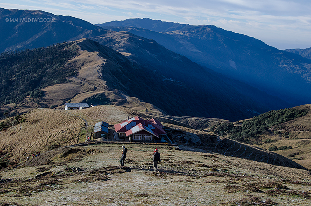
If you climb just a little from those cottages, the Kanchenjunga just seems to embrace you. There is a border pillar here that separates India’s West Bengal, Sikkim and Nepal. There is a trekking route in front that goes to a place called Changthaphu in Nepal but the guides do not allow taking that road, however, the trekking agencies from Darjeeling use this route to get Changthaphu. Kanchenjunga can be seen even more closely and clearly from there.
Phalut to Ramam / Srikhola
Altitude 3599 meters to 2102 meters, time 7-8 hours, distance 24 kilometers
After watching the glorious morning view and taking breakfast, descend to Gorkhey through Singalila forest. The road is so attractive that if you are a cyclist you will be itching for a Mountain Bike. You do not even need to paddle as the trek gradually descends through a zigzag way. With that there are chirpings of innumerable birds in the forest. Never make any loud sound or listen to music through a headphone there lest you will miss the spellbinding concert of birds. And the wind that blows through the jungle creates the melody of a flute that gives a ethereal feeling.
A mountain river called Gorkhey Stream flows past the Gorkhey valley. It is originated somewhere in the Srikhola. If you have time you may explore the place. The local shifting cultivation gives the valley a picturesque look. There are many cottages in Gorkhey Valley. You can stay in any of those or may go to Rammam after spending some time there.
The next stoppage from Gorkhey is Rammam but strategically it is better to stay at Srikhola or in Gorkhey. The route goes from Gorkhey to Srikhola via Rammam but if you have scarce of time you may bypass Srikhola and go to Rimbik through Sippey shortcut.
It is recommended to stay in Srikhola for a day because the ethereal feeling that one gets while staying in a cottage beside the mountain river is impossible to describe in words. Rimbik is next. One may come from very close from Srikhola or one may come from Rammam skipping Srikhola vai Sippey. From Rimbik two shared jeeps go to Darjeeling- one at 11:30 and the other at 12:30. You may go to Darjeeling or descend at Manebhanjan.
Fast Trekking
*** You can always reach from Maneybhanjan to Gairbas in 1 day and then Gairibas to Sandakphu on next day.
Expense:
Siliguri to Manebhanjan shared jeep: 120/130 rupees
Siliguri to Manebhanjan reserve jeep: 2800-3000 rupees
Nightstay at Manebhanjan Double Bed: 400-500-700 rupees, single bed: 200-300 rupees, Dormitory- 100-150 rupees
After that the seat fare of every dormitories in the trek: Single 250 rupees, double bed 500 rupees
Food per meal per person: 200/300 rupees depending on menu
At Sandakphu in Sherpa Chalet Hotel: double bed 800/1000/1200 depending on season and at dormitory per seat with 250 rupees
Guide: According to the information of 2016 per day 600-700-800 rupees, you do not need to pay extra for their food and dwelling.
Rimbik to Darjeeling shared jeep fare: 140/150 rupees
*** All the expenditure info here and above can be changed by each season ahead. We will try to add up the latest info and we would encourage you to input any info that is updated into the comment section. Thanks.
TIPS
Precaution:
- Sandakphu-Phalut trek is rather easy but if anybody climbs in high altitude quickly one may become a victim of acute mountain sickness of AMS. So if any sort of headache, stomach ache, stomach upset, dizziness, tiredness, nausea occurs one must straightaway descend from the trek.
- Prepare an urgent plan by discussing with the guide on how you can quickly reach the city underneath in case of emergency.
- Water is not available in every part of the trail. So make your whole plan accordingly and fill the water bottle whenever you get an opportunity.
- Alcohol is readily available here since the T-house trek was set. But remember, consuming alcohol at high altitude will make you sick. You may fell ill quickly and even your life may come under threat.
Tidbits :
- Nepalese guides are not that fluent in English.
- If you can reach Manebhanjan two hours before the evening and arrange a guide from Guide Association after finishing your passport entry within 30 minutes you may start trekking. In that case you may stay at night at Chitray. Just crossing 3-4 kilometers of the road will make a good start of the trekking because the whole road is uphill but the road is covered with pitch. There are some shortcut trails and you may go straight uphill by evading the angular distance of the main road.
- If you arrive Manebhanjan at evening at first manage your dinner in a food shop because these restaurants close their shutters just after the evening
- If possible meet Jivan Chitrey [Jibhan Chetre died in 2020], who is known as Masterji in the locality, because an opportunity to discuss with him is a bonus in this trek
- Without any hesitation you may order Khichdi and Omlet as your dinner
- Whenever you will get time, talk with cottage owner, cook and guide to know about the place. It will fulfill your goal of the trekking. If you listen to their story, you can also write them down. So trek and write down the experience of your voyage.
*** All the above information are based on the time when the place was visited. There could be changes on timing and expenses anytime.
